
Béréré Fm
Type Locality and Naming
East of Tanout, in the extreme north of the Damergou Gr. Joulia, 1953. Furon (1964) mentions the “formation inférieur de Béréré” (Late Cenomanian) and the “formation supérieur de Béréré” Early Turonian).
References: Furon, 1933, 1934, 1935, 1964 ; Cottreau, 1934; Joulia, 1953; Faure, 1966, page 159; Fabre et al., 1983; Moody et al., 1991 ; Rat et al., 1991 ; Mathey et al., 1991; Mateer et al., 1992 ; Meister, 1992; Mathey et al., 1995 ; Moody, 1997.
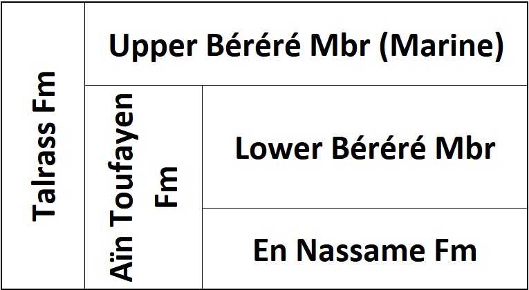
Synonym: Berere Fm. Part of the old Talrass and Aïn Toufayen Formations (Fig. 1); Equivalent(s): Iguéllala Mountains Fm; Zoo Baba Fm; Arentigué Fm; It is the "Lumachelle à Neolobites" (Greigert, 1966) which only exists in the extreme north of the Damergou.
[Figure 1: Synonyms of the Béréré Fm]
Lithology and Thickness
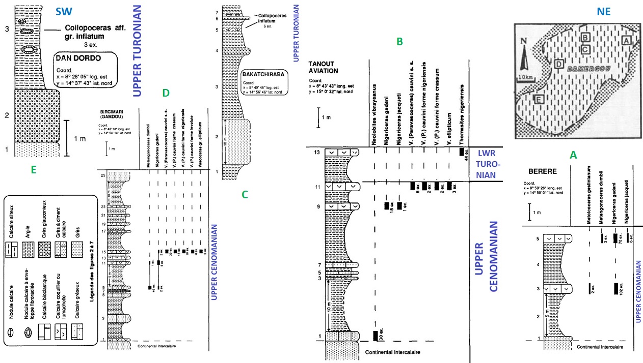
The upper part is marine with limestones and sandy yellow dolomitic limestones. Overall, the bulk of the formation displays laminated clays separating fine sandstones and clays; lumachellic limestone beds. Clays, limestones are containing fine quartz grains, medium-grained feldspathic and micaceous sandstones, which are bioclastic, slightly glauconitic and cemented by sparite (Fig. 2). Its thickness is ~66 m.
[Figure 2: SW-NE cross-section within the Damergou area from Upper Cenomanian to Upper Turonian (Béréré Fm and Gangara Fm). Created from data in Meister et al., 1992]
Relationships and Distribution
Lower contact
Underlying unit is the Farak Fm [?
Upper contact
Overlying unit is the Gangara Fm
Regional extent
GeoJSON
Fossils
The macrofauna, varied and well-preserved, comprises echinoderms, bivalves (particularly Exogyra), gastropods, nautiloids, and ammonites (Neolobites vibrayeani), Plicatula fourneli Coq, Micropedina olisiponensis Forbes, Cardium productum Sow., Pholadomya pedernalis Roemer, Hoplitoides nigeriensis Woods, Metengonoceras dumbli Cragin, Metengonoceras nigeriensis Furon, Nigericeras gadeni Chudeau, Nigericeras jacqueti Schn., Nigericeras lamberti Schn., Nigericeras gignouxi Schn., Vascoceras crassus Furon, Paravascoceras Chevalieri Furon, Paravascoceras Chudeaui Furon, Paravascoceras nigeriensis Woods.
Age
Depositional setting
Marine
Additional Information
This is the beginning of the first of several marine transgressions across West Africa.